

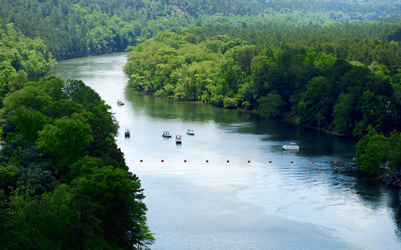
Discover the hidden gems of the South.
Have you ever imagined paddling through tranquil lakes and winding rivers?
The best places to paddle board in Arkansas are waiting for you to explore.
Embark on an adventure through the Natural State’s breathtaking scenery.
Are you ready for the journey?

Map
Planning Your Paddle in Arkansas
Season figures are averages of the daily maximum temperature in the ERA5 climate archive for 2019 to 2024. Every spot below can carry its own rules on top of these.
- Season: average daily highs clear 59 °F from March through November. July is the warmest month, averaging 90 °F, and outside that window a wetsuit is what separates a short session from a comfortable one.
- Rules and licences: The US Coast Guard treats a paddleboard as a vessel as soon as you leave the immediate swimming or surfing area. From that point a wearable life jacket for every person on board is required, together with a sound signal, and a white light after dark. Individual states add their own rules on top, so check the state boating agency before a longer trip.
Where to Paddle Board in Arkansas
Please note: While we strive for accuracy, always verify details before paddling. If you spot an error or if you're a local official wanting to make a correction, please comment below. Thanks!
#1 Lake Ouachita
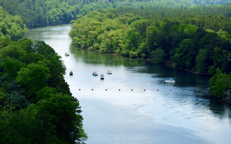
- 🏖️ Location Type: Lake
- 📍 Access Point: Lake Ouachita State Park (Google Maps)
- 🌊 Water, Currents & Wind: Calm, clear lake water, occasional wind
- ☀️ Popular Seasons: Summer and Early Fall
- 🐟 Wildlife Encounters: Bass, catfish, bald eagles, waterfowl
- 🏞️️ Landmarks & Views: Scenic shoreline, surrounding forest
- ⚠️ Safety, Environment and Rules: Be cautious of boat traffic, swim only in designated areas
Lake Ouachita, nestled in the Ouachita National Forest, is the largest lake in Arkansas. Its clear waters, stunning views, and numerous islands make it an ideal paddleboarding destination.
Explore Lake Ouachita’s extensive shoreline and enjoy a peaceful experience surrounded by nature.
#2 Buffalo National River
- 🏖️ Location Type: River
- 📍 Access Point: Steel Creek Access (Google Maps)
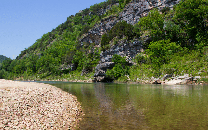
- 🌊 Water, Currents & Wind: Gentle currents, minimal wind
- ☀️ Popular Seasons: Spring to Fall
- 🐟 Wildlife Encounters: Fish, turtles, herons, beavers
- 🏞️️ Landmarks & Views: Limestone bluffs, forests
- ⚠️ Safety, Environment and Rules: Avoid during high water, respect private properties
The Buffalo National River, the first designated National River in the United States, flows through the heart of the Ozark Mountains. Its pristine, turquoise waters are perfect for a serene paddleboard adventure.
Marvel at the dramatic limestone bluffs, catch glimpses of various wildlife, and experience a unique slice of Arkansas nature.
#3 Beaver Lake
- 🏖️ Location Type: Lake
- 📍 Access Point: Horseshoe Bend Public Use Area (Google Maps)
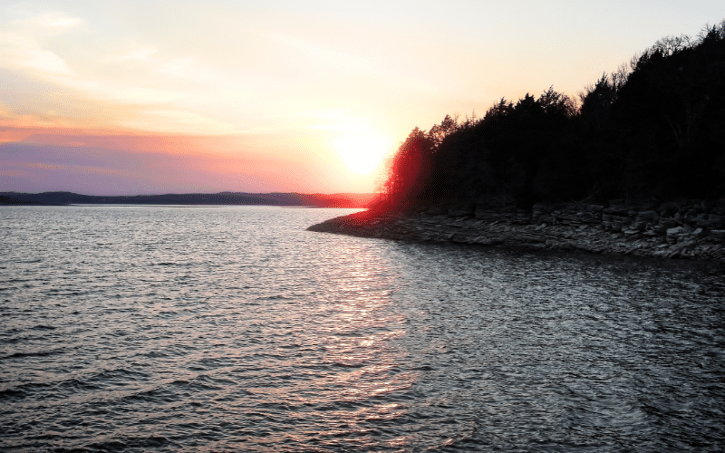
- 🌊 Water, Currents & Wind: Calm waters, occasional winds
- ☀️ Popular Seasons: Summer and Early Fall
- 🐟 Wildlife Encounters: Bass, walleye, deer, turkeys
- 🏞️️ Landmarks & Views: Rocky bluffs, forested landscapes
- ⚠️ Safety, Environment and Rules: Be cautious of boat traffic, adhere to designated zones
Beaver Lake, a scenic reservoir in the Ozark Mountains, offers miles of shoreline to explore. With its clear waters surrounded by forests and rocky bluffs, the lake promises a peaceful and picturesque paddleboarding experience.
Enjoy the tranquility of Beaver Lake’s coves and inlets, and keep an eye out for deer and turkey along the shores.
#4 Lake DeGray
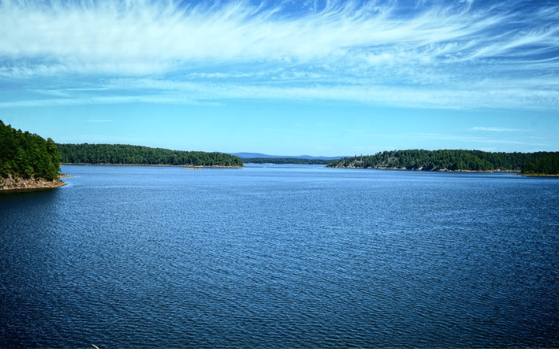
- 🏖️ Location Type: Lake
- 📍 Access Point: DeGray Lake Resort State Park (Google Maps)
- 🌊 Water, Currents & Wind: Calm waters, light winds
- ☀️ Popular Seasons: Summer and Early Fall
- 🐟 Wildlife Encounters: Bass, catfish, eagles, herons
- 🏞️️ Landmarks & Views: DeGray Dam, forested shores
- ⚠️ Safety, Environment and Rules: Respect park rules, be cautious of boat traffic
Lake DeGray, located in the foothills of the Ouachita Mountains, offers a serene paddleboarding experience, perfect for nature lovers. Its clear waters and lush, forested shores make for a stunning backdrop.
As you paddle around the lake, watch for eagles and herons soaring overhead, adding to the natural beauty of the area.
#5 Little Maumelle River
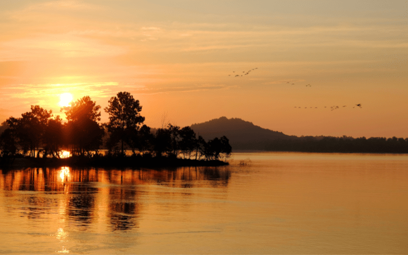
- 🏖️ Location Type: River
- 📍 Access Point: Two Rivers Park (Google Maps)
- 🌊 Water, Currents & Wind: Gentle currents, minimal wind
- ☀️ Popular Seasons: Spring to Fall
- 🐟 Wildlife Encounters: Fish, turtles, herons, ducks
- 🏞️️ Landmarks & Views: Forested banks, wetlands
- ⚠️ Safety, Environment and Rules: Watch for water levels, respect private property
The Little Maumelle River, a tributary of the Arkansas River, meanders through wooded banks and wetlands near Little Rock. Paddleboarders can enjoy the peaceful, meandering river surrounded by diverse wildlife.
Whether spotting herons wading in the shallows or exploring hidden inlets, the Little Maumelle River offers a tranquil escape from city life.
#6 Greers Ferry Lake
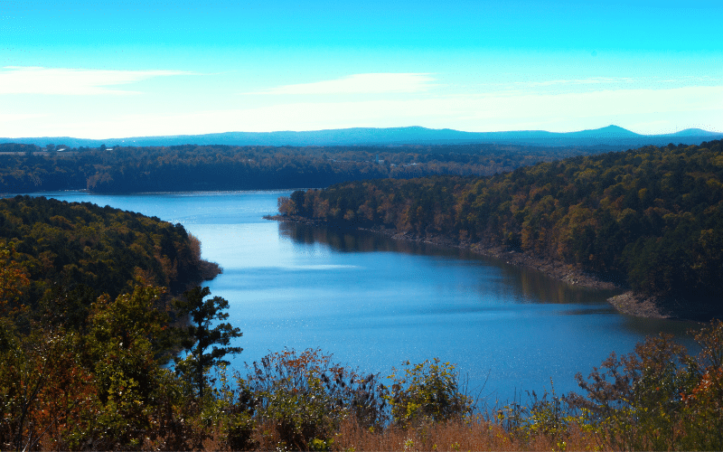
- 🏖️ Location Type: Lake
- 📍 Access Point: Cove Creek Recreation Area (Google Maps)
- 🌊 Water, Currents & Wind: Calm waters, occasional wind
- ☀️ Popular Seasons: Summer and Early Fall
- 🐟 Wildlife Encounters: Bass, melons, deer, turkeys
- 🏞️️ Landmarks & Views: Forested shores, Sugar Loaf Mountain
- ⚠️ Safety, Environment and Rules: Be cautious of boat traffic, adhere to designated zones
Greers Ferry Lake, nestled in the Ozark foothills, boasts crystal-clear waters ideal for paddleboarding. Its long stretches of forested shoreline provide a serene and picturesque setting for outdoor enthusiasts.
Explore the lake’s many coves and inlets or enjoy views of the nearby Sugar Loaf Mountain as you paddle through this scenic Arkansas lake.
#7 Caddo River
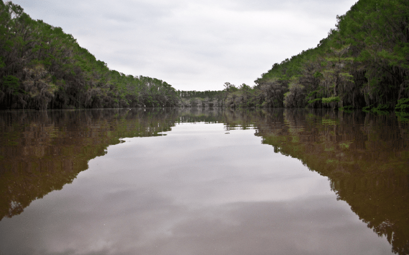
- 🏖️ Location Type: River
- 📍 Access Point: Caddo Valley Access (Google Maps)
- 🌊 Water, Currents & Wind: Gentle currents, minimal wind
- ☀️ Popular Seasons: Spring to Fall
- 🐟 Wildlife Encounters: Fish, turtles, herons, ducks
- 🏞️️ Landmarks & Views: Forested banks, small rapids
- ⚠️ Safety, Environment and Rules: Be cautious during high water, respect private property
The Caddo River offers a picturesque paddleboarding experience as it flows through the Ouachita Mountains’ beautiful scenery. The river provides a mix of calm flatwater stretches and mild rapids, making it ideal for a diverse range of skill levels.
As you paddle along the tree-lined banks, you’ll find serene spots perfect for picnics and swimming, offering a true Arkansas nature experience.
#8 Lake Catherine

- 🏖️ Location Type: Lake
- 📍 Access Point: Lake Catherine State Park (Google Maps)
- 🌊 Water, Currents & Wind: Calm waters, occasional wind
- ☀️ Popular Seasons: Summer and Early Fall
- 🐟 Wildlife Encounters: Bass, catfish, waterfowl
- 🏞️️ Landmarks & Views: Forested shores, rolling hills
- ⚠️ Safety, Environment and Rules: Be cautious of boat traffic, adhere to park rules
Lake Catherine, located within Lake Catherine State Park, is a peaceful destination for paddleboarding enthusiasts. The clear waters of the lake are surrounded by lush, forested shores and rolling hills, making it an idyllic spot for outdoor lovers.
Explore the quiet coves and inlets of Lake Catherine as you take in the picturesque beauty of this Arkansas gem.
Arkansas rewards paddlers who are willing to drive. Beaver Lake is the headline water in the north-west, and once you follow the river corridor upstream, Creve Coeur Lake outside St. Louis and Devils Lake in North Dakota are the next stops worth the mileage.

What to Take With You
Whatever the water here looks like, the same short list comes along. Each box below shows the model that currently sits at number one in our own test of that category.

- Typefoam, paddle cut
- ApprovalUSCG and Transport Canada
Every model we tested: 10 Best Life Vests for Paddle Boarding

- Cordcoiled, stretches to 9 ft
- Swivelstwo in-line
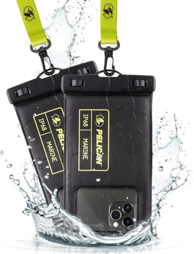
- RatingIP68 certified, 1 m for 30 minutes
- Floatsyes

- Capacity20 L, range from 10 to 55 L
- Material500D PVC tarpaulin
Every model we tested: The 9 Best Dry Bags for Paddle Boarding

- Typetall neoprene boot
- Thickness3 mm
FAQ
Where can you paddle board in Arkansas?
Popular paddle boarding spots in Arkansas include Lake Ouachita, Beaver Lake, Buffalo National River, and Greers Ferry Lake.
Do paddle boards need to be registered in Arkansas?
No, paddle boards do not require registration in Arkansas.
When is the best time to paddle board in Arkansas?
Spring through fall is ideal for paddle boarding in Arkansas, due to moderate temperatures.
Paddle Boarding Near Arkansas
Looking for another spot on the same trip? These guides cover the closest paddling waters we have mapped around Arkansas.
- Beaver Lake (121 miles north)
- Mississippi Delta (142 miles southeast)
- Caddo Lake (152 miles southwest)
- Missouri


